See America First! – Postcard Edition

See America First promotional postcard.
A promotional postcard from the Denver and Rio Grande railroad featuring one of their scenic excursion lines in the Rocky Mountains. Postcard from the author’s personal collection.

Consider the lowly postcard. Largely forgotten today, postcards were once big business and an almost obligatory aspect of family vacations. Despite their modern decline, however, postcards were instrumental in facilitating both domestic American tourism and aspects of American national identity itself. The vacation postcard also had a specific, deliberate origin in early American tourism promotion beginning in the late nineteenth century through a national movement known as See America First.

Historian Marguerite Shaffer, in her book, See America First: Tourism and National Identity 1880-1940 first investigated the significant role tourism played in constructing an American national identity. My own research built on Shaffer’s work and examined evolving local community identity driven by tourism in the twentieth century American Southwest. 

As Shaffer documented, tourists were encouraged to seek out American destinations for vacations, particularly in the American West, by the See America First movement. See America First was a national movement led by community boosters across the country, domestic tourism promoters, Department of the Interior and later National Park Service officials, and railroad and automobile company leaders that encouraged Americans to spend their tourism dollars visiting American locations.[1]

Although not explicitly articulated by See America First proponents, the arguments of the See America First movement connected to aspects of American republican mythology and national identity. Within this framework, tourism, particularly Western tourism, helped to reconcile virtuous agrarian republican mythology with the reality of the emerging industrial, corporate-driven, urban nation.[2] 

First Western boosters, and then a far more successful partnership between the railroads and the National Park Service, promoted tourism as an act of patriotism. These efforts encouraged Americans to visit the natural wonders of America like the Grand Canyon in an effort to know their own country and develop a sense of national pride. These efforts further redefined the natural world in the Western United States from harsh wilderness needing conquering to scenic wonder needing visitation. Through this, tourism became a type of virtuous consumption that reconnected urban elites to the original republican virtues of America through visiting the natural wonder of the United States.[3] Subsequent promotion efforts cast escaping to nature through tourism as a rite of passage required for virtuous citizenship.[4] Tourists themselves internalized these messages adding aspects of defining self-identity to pastoral tourism.[5]

A significant aspect of this national movement were promotional materials, most of which took printed form. Beginning in the late-nineteenth century railroad era, posters, newspaper and magazine articles, and other printed materials were used to promote the movement and grow interest in domestic travel amongst Americans. Although many readers may be familiar with the now iconic early twentieth century National Park Service posters, a far more prolific medium was often used to promote domestic tourism: the postcard.


See America First postcard featuring a railroad train excursion through the Rocky Mountains.
This postcard produced by the Denver and Rio Grande railroad was one of the many promotional postcards produced as part of the See America First movement. Postcard from the author’s personal collection.

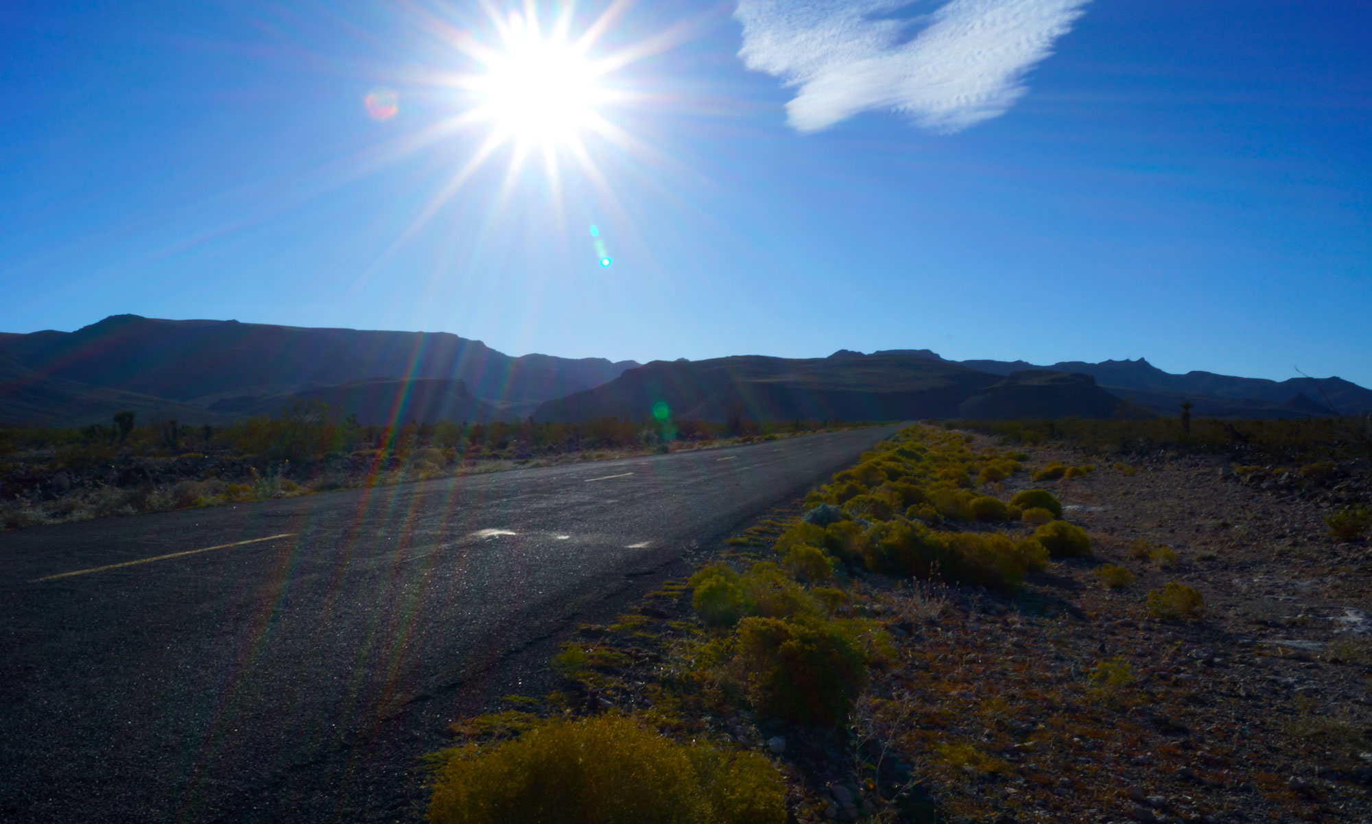
Postcards like the one shown above were instrumental in advancing the aims of the See America First movement. Postcards like this one served two purposes: to reinforce in the tourist’s mind the importance of their personal journey out west, and to engender interest for future trips by the recipients of postcards sent by western tourists.

See America First postcard promoting modern travel by rail.
Postcards like the ones in this series were explicit in promoting American tourism, the technological progress made by America in a short period of time, and America’s status as a modern nation worthy of visitation via modern transportation technology. Postcard from the author’s personal collection.

These postcards, sold to tourists as souvenirs, were explicit in their mission of promoting America. Often focusing on the western United States, these materials promoted American natural wonders as destinations on par with anything in Europe. See America First postcards hailed hallmarks of the western American natural environment as the “cathedrals of America,” that were as worthy of visitation as any castle or capital city outside the U.S. Likewise, these postcards also promoted America as a fully modern nation commanding a continent through transportation technology and systems like transcontinental railroads. In this view, America not only had wild natural splendors worthy of visitation, but the modern means to whisk tourists to these destination with ease – all to the benefit of American tourism promoters.

The postcard as a means of correspondence, remembrance, or promotion has largely died out. In many ways serving as the canary in the coal mine for written correspondence and national postal services in general, the postcard along with hand-written letters, has largely been replaced by newer communication mechanisms like email and social media. Digital photography and Instagram eliminated the need to buy postcard packs to commemorate vacations. However, for a time, postcards played an instrumental role not only in personal tourism memory making, but in ushering in fundamental aspects of American identity like the ubiquitous family vacation out west.


[1] Marguerite S. Shaffer, See America First: Tourism and National Identity, 1880-1940 (Washington: Smithsonian Institution Press, 2001), 1-6, 130-168. Warren James Belasco, Americans on the Road: From Autocamp to Motel, 1910-1945 (Baltimore: John Hopkins University Press, 1979), 3-40.

[2] Shaffer, See America First, 5-6.

[3] Ibid., 7-39.

[4] Ibid., 219.

[5] Ibid., 264.

Interview Featured in Arizona PBS Magazine Article

I gave an interview to Arizona PBS for an article in their subscriber magazine. The article focused on the history of tourism in Arizona. The article delved into the development and marketing of the “Arizona allure,” and how reality on the ground in Arizona often differed widely from how the state was marketed to tourists. I spoke to how the development of the Santa Fe railroad and Route 66 influenced the development and marketing of tourism in Arizona. I also spoke to the impact of tourism on indigenous people – particularly on their interactions with tourists from outside Arizona.

Access the article here.

New Article in California History journal

The journal California History published an article of mine about the impact of transportation infrastructure disinvestment on Seligman, Arizona. The California connection derives from the state, and particularly Barstow, California, being the primary beneficiary of investments in interstate highways and the modernization of the Santa Fe railroad that led to the bypassing of Seligman, Arizona — a community on Route 66 and a former major hub of maintenance and switching operations for the Santa Fe railroad.

You can access the article here.

1926-Era Route 66

The photograph below is of a portion of the 1926 alignment of U.S. Route 66 just east of Ash Fork, Arizona. This alignment of the road is several miles north of the post-war alignment that was replaced by I-40.

The road is much narrower than later versions. It has two traffic lanes but the paved portion of the road would have just been wide enough for passenger cars of the era to pass each other. Encountering a truck would have required a drive to pull over to the side of the road to allow it to pass. Pavement is the typical reddish colored macadam of the era. There are no paved shoulders or curbs throughout this section.

Route 66 east of Ash Fork, Arizona
Route 66 east of Ash Fork, Arizona (1926 Alignment)

Could new legislation lead to a Route 66 economic revival?

Frontier Motel Sign

I wrote an article for The Conversation about Route 66 and the amendment of the National Trails System Act to add Route 66 as a federally recognized historic trail. Federal recognition brings historic preservation and economic development benefits to communities along the route.

Federal recognition will go a long way to allow places like Peach Springs, Arizona to capitalize on their history to rebuild their economies after the interstate bypass decimated them.

This old gas station, for example, qualifies for the National Register of Historic Places. This amendment could help deliver resources to get it listed and preserved.

Abandoned Standard Oil Station in Peach Springs, Arizona
An abandoned Standard Oil gas station in Peach Springs, Arizona

Read the article here: http://theconversation.com/could-new-legislation-lead-to-a-route-66-economic-revival-98601


Route 66 Decertified June 26, 1985 – Significant Consequences for Route 66 Communities

Abandoned Standard Oil Station in Peach Springs, Arizona

On June 26, 1985, highway officials decertified Route 66. The decertification vote ended Route 66 as a federal highway diverting traffic away from remaining segments. This action had significant impacts for communities along the route with many suffering steep economic decline or becoming ghost towns.


Abandoned Standard Oil Station in Peach Springs, Arizona
An abandoned Standard Oil gas station in Peach Springs, Arizona

This abandoned gas station is in Peach Springs, AZ. Cars would have been lined up three deep at these pumps before the bypass.

An abandoned building from an auto-camp in Two Guns, Arizona.

The community of Two Guns, Arizona, despite getting an exit off of I-40, became a ghost town after Route 66 was decertified. Abandoned building like this former auto-camp are all that is left.

The interstate highway project was viewed by many as a shining example of progress. For many communities in America, however, it ushered in an era of steep decline and even oblivion.

San Juan – Marshall Housing Ownership Changes Dataset

Attached is a data set for an analysis of housing ownership changes in the San Juan Marshall neighborhood. The data analysis shows that the neighborhood had an initial period of high stability followed by a period of relative instability between 1964 and 2000 when properties changed hands frequently.

This chart shows ownership changes for three properties in San Juan - Marshall from 1946 to 2000. 1946 to 1964 represents a period of high stability with no ownership change. The period from 1964 to 2000 has ownership changes of four or more owners.
This chart shows ownership changes for three properties in San Juan – Marshall from 1946 to 2000. 1946 to 1964 represents a period of high stability with no ownership change. The period from 1964 to 2000 has ownership changes of four or more owners.

ownership changes 1946-2000

Housing Styles In The San Juan – Marshall Neighborhood

This is an example of a house built in a style popular before WWII. This square-shaped style would be completely replaced by ramblers post-war.

This is a gallery of photographs showing the diversity in housing styles in the San Juan – Marshall neighborhood. Unlike most post-war neighborhoods, the San Juan – Marshall neighborhood was developed with a mix of housing styles including earlier pre-war styles, pre-war ramblers and post-war ramblers. The houses also reflect diversity in construction methods from traditional block to wood and stucco. This diversity in housing stock is evidence of how the neighborhood was a transitional place where the old methods of development were giving way to new post-war methods.

Gallery Wordpress

Overlooked But Not Forgotten: Rediscovering the San Juan – Marshall Neighborhood

The Corner of Missouri and Seventh Avenues in Phoenix Arizona

Wedged between affluent Rancho Solano and historic Medlock Place, sits a neighborhood at the vertex of post-war urban change in Phoenix. Given the nature and timing of its development, it is a strong candidate for historic preservation. However, it has not received historic status due to class issues and a city ethic that values progress and redevelopment over preservation[1]. Specifically, it has likely been overlooked for historic designation because it was a neighborhood of affordable homes sandwiched between two larger affluent neighborhoods,[2] and since preservation efforts in Phoenix largely are citizen led[3].

This map shows the location and boundaries of the San Juan - Marshall neighborhood. The highlighted area is between Seventh and Central Avenues, and Missouri Avenue and the now abandoned San Miguel Avenue.
This map shows the location and boundaries of the San Juan – Marshall neighborhood. The highlighted area is between Seventh and Central Avenues, and Missouri Avenue and the now abandoned San Miguel Avenue.

In the period from 1945 to 2000, it underwent two distinct periods of change. The first was a rapid period of transformation where the area transitioned from farming to residential housing from 1946 to 1959. This shift was fueled by the larger trend of rapid post-war urban expansion across the country[4]. Likewise, during this time home building rapidly changed. Individual builders contracting with lot owners directly gave way to larger builders utilizing mass production techniques.[5] This neighborhood straddles these transformations.

Map showing changes in the San-Juan - Marshall neighborhood from 1949-2000
This map illustrates the change over time in the San Juan Marshall neighborhood from 1946 to 2000. Areas where structures overlap are where older buildings were demolished for new construction.

The second was a period of redevelopment beginning in the late 60s fueled by the exodus of the original homeowners. This period saw some of the original homes redeveloped into denser multi-unit developments, the expansion of commercial property, and then a retrenchment from commercial development[6]. However, the bulk of the original neighborhood remains, and is historically significant as an example of a place caught between the slower, smaller pre-war growth conducted on a more individualized scale, and the post-war mass production housing boom starting in the mid-50s.

This chart shows ownership changes for three properties in San Juan - Marshall from 1946 to 2000. 1946 to 1964 represents a period of high stability with no ownership change. The period from 1964 to 2000 has ownership changes of four or more owners.
This chart shows ownership changes for three properties in San Juan – Marshall from 1946 to 2000. 1946 to 1964 represents a period of high stability with no ownership change. The period from 1964 to 2000 has ownership changes of four or more owners.

Digital history methods were used to document the neighborhood’s history and change over time. Primary documents were analyzed from online databases such as county recorder and assessor records, aerial photographs, digital newspaper collections, and discussions with local residents. Analysis methods included photo analysis, HGIS map creation, charting real estate data, oral history, and textual analysis of newspaper articles.


[1] Gober, Patricia. Metropolitan Portraits: Metropolitan Phoenix: Place Making and Community Building in the Desert. Philadelphia, US: University of Pennsylvania Press, 2013. Accessed October 26, 2016. ProQuest ebrary.

[2] “High Class,” Arizona Republic (Phoenix, AZ), July 3, 1946. “$1150 Beat These,” Arizona Republic (Phoenix, AZ), November 23, 1946. “Open 1-5 Today 518 West San Juan,” Arizona Republic (Phoenix, AZ), January 22, 1950; the home advertised here was listed for $13,500. A year earlier, a Rancho Solano home was listed for $40,000, see “Luxurious Rancho Solano Estate,” Arizona Republic (Phoenix, AZ), May 29, 1949.

[3] “Historic Preservation FAQs” City of Phoenix, Accessed December 2, 2016, https://www.phoenix.gov/pdd/about/faq/historic-preservation-faqs

[4] “Historical Aerial Photography,” Maricopa County GIS Portal, Accessed December 2, 2016, http://gis.maricopa.gov/MapApp/GIO/AerialHistorical/index.html. See aerial photos for this area for 1949, 1953, and 1959. For a description of the rapid urban growth in Phoenix specifically and the United States generally during this period see Philip VanderMeer’s book Desert Visions and the Making of Phoenix, 1860-2009, pages 187 – 205.

VanderMeer, Philip. Desert Visions and the Making of Phoenix, 1860-2009. Albuquerque, US: University of New Mexico Press, 2012. Accessed October 26, 2016. ProQuest ebrary.

[5] VanderMeer, Philip. Desert Visions and the Making of Phoenix, 1860-2009. Albuquerque, US: University of New Mexico Press, 2012. Accessed October 26, 2016. ProQuest ebrary.

[6] “Historical Aerial Photography,” Maricopa County GIS Portal, Accessed December 2, 2016, http://gis.maricopa.gov/MapApp/GIO/AerialHistorical/index.html. See aerial photos for this area for 1949, 1953, 1959, 1969, 1979, 1997, and 2000. 1949 to 1959 show the area building out as residential homes. 1969 to 1979 show the encroachment of commercial property and the building of multifamily housing, and the 1997 and 2000 photos show the reclaiming of land for residential use particularly along San Juan Avenue near Central Avenue.

The Digital Turn: How Digital Tools and Visualization Methods Shape Place History

3D View of San Juan - Marshall Neighborhood

Digital history tools and methods have shaped spatial analysis, data analysis, and visualization of that data in profound ways. Many discussions of digital history focus on data analysis versus visualization. However, the two are more complementary than divergent. I have found data analysis tools often generate interesting visuals, and the process of creating visualizations of data analysis often creates new insight into the data creating new pathways for further analysis.

Straightforward examples of this are charts and graphs. The term visualization can seem complicated until you realize that it is simply referring to rendering data in a visual format rather than text. One of the most ubiquitous types of visualization is the data chart. Most people inside and outside of academia have seen and often created charts for school, work, or personal projects. Charts have a unique ability to render complex data accessibly.

Currently, I am conducting a place history of a small north-central Phoenix, Arizona neighborhood. I will be using charts as a powerful visualization tool to demonstrate factors driving change over time in this neighborhood. The neighborhood I am analyzing was part of the post-war housing boom that expanded Phoenix northward rapidly in the decades following WWII. Multiple factors propelled the expansion of the city northward, however a prominent driver of this expansion was affluent Phoenicians seeking larger homes on larger lots during the post-war economic expansion. As such, class factors heavily into the history of north-central Phoenix neighborhoods. Given this, consider the following chart:

Median Income 1990 to 2013 in North central Phoenix, Arizona

Although outside of the specific time period I am analyzing for my place history, this chart (based on census data from socialexplorer.com), visualizes median income changes in inflation adjusted 2013 dollars over the 1990 to 2013 time period. It focuses on the census tracts north of McDowell Avenue and south of Northern Avenue in Phoenix. Pre-war, Phoenix ended at Thomas Avenue (Census tract 1118). Known as the Willow neighborhood, census tract 1118 has historically been wealthy. Census tracts 1105, 1171, and 1088 north of town pre-war were largely farming areas or locations where cheap lots could be purchased for home building. Post war, intense housing expansion began in census tracts 1075 (Medlock Place), 1066 (San Juan Marshall and Rancho Solano), and 1062. Medlock Place and Rancho Solano were marketed to wealthy homebuyers looking for larger lots and bigger homes in the late 40s and early 50s. Census tract 1062 featured even larger properties built in the 60s. Over time, the wealthy leapt over census tracts 1105, 1171, and 1088 seeking larger and larger properties northward. The data visualized in the chart suggests the effects of this leap frogging pattern persisted into the present with 1075, 1066, and 1062 retaining their wealthy inhabitants and 1105, 1171, and 1088 remaining poorer. The effects of income inequality over the last twenty-five years can also be seen as the richer census tracts largely retain and grow their wealth whereas median income in the poorer census tracts stays flat or declines.

This chart is a straightforward example of how data visualization can make complex trends readily accessible. For my place history, I intend to use charts to visualize aspect of change in the neighborhood like the ones shown in this chart. A specific example I am working on is charting the quantity of lots for sale as expressed in newspaper ads in the Phoenix Republic each year from 1945 to 1985 to show the size and pace of the post-war housing boom. Another, more narrow example, is to similarly chart the number of ads over time for lots and homes available in San Juan – Marshall to visualize how quickly the neighborhood filled in.

3D visualizations are another example of digital visualizations both making complex data accessible and creating new insight into the data. Although some may be surprised that 3D modeling is used in digital history, many historians have utilized 3D modeling techniques to great effect. The St. Paul’s Cathedral Project hosted by North Carolina State University is an example. The project recreated St. Paul’s Cathedral from the early seventeenth century using 3D modeling. The recreation allows viewers to experience what worship and preaching at the cathedral was like in that time. Specially, the project recreated the physical environment in existence when parishioners heard John Donne’s sermon for Gunpowder Day on November 5th, 1622 in Paul’s Churchyard located in the center courtyard of the structure. The project used 3D modeling to recreate both the physical space and texture mapping to emulate the building surfaces. This data was then used to acoustically model the space so that a recording of Donne’s speech could be made that would sound like how parishioners heard it during the actual sermon centuries ago. Recreating an environment like this using 3D modeling tools is particularly useful when you consider that the structure in question no longer exists. Old St. Paul’s cathedral burned down centuries ago. It is only accessible to researchers and the public through this virtual modeling project.

I am using 3D modeling in my place history as well. Here is an example:

3D View of San Juan - Marshall Neighborhood
A 3D View of the San Juan – Marshall neighborhood from the Setter Farm looking west.

Based on an aerial photograph from 1949, this 3D scene looks west from the modern intersection of San Juan Avenue and Central Avenue in Phoenix. From this vantage point, The Setter Farm is in the foreground with the Otter Farm to the South and the San Miguel subdivision in the background to the far west. The San Miguel subdivision was the first part of the San Juan – Marshall neighborhood plated and built. From a modern perspective, this entire area is all homes now. It is natural to assume it has always been like that. As I built this model and analyzed it from various perspectives, I settled on the point-of-view shown as particularly insightful. From this vantage point, the agricultural orientation of the area is quite prominent. Viewed from the San Miguel side, the model view seems to suggest a suburban dominance. However, viewed from the Setter Farm side you see that in 1949 agriculture still dominated the area. By 1959 this was no longer the case as all the farms are gone.

This is an example of how data visualizations can create new insights that lead to new avenues for research. Given the insights gleaned from this model, I intend to build further models off of newer aerial photographs to see what these visualizations tell me about the changes the area experienced over time.

As these examples illustrate, digital analysis tools and digital visualizations work together in a complementary fashion. The tools allow for data creation and analysis that often yields insightful visualizations. The visualizations, however, can also lead to new perspectives and avenues for further research. This powerful combination is continually shaping the practice of history.


“Virtual St Paul’s Cathedral Project.” Virtual St Paul’s Cathedral Project. Accessed November 20, 2016. https://vpcp.chass.ncsu.edu/

“Median Household Income.” Social Explorer. Accessed November 20, 2016. http://census.socialexplorer.com/pop-flash/